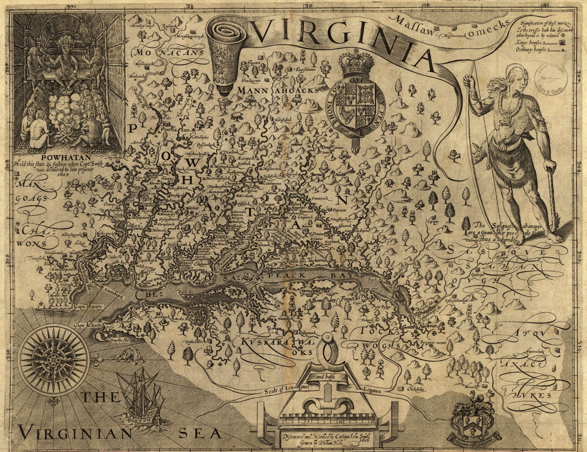
The English arrived in Virginia in 1607, in a region known locally as Tsenacommacah, meaning “densely inhabited land.” The next year, Captain John Smith led two major voyages exploring the Chesapeake Bay.
He traveled thousands of miles, making maps using only a compass and a few basic tools. Smith published this landmark map in 1612 as the definitive record of his voyages. It captures with impressive accuracy the serpentine shoreline, islands and rivers emptying into the Atlantic Ocean (here, the Virginia Sea), including the James, Potomac and Susquehanna rivers. The map also documents hundreds of Indigenous communities. At the top left, a vignette shows the paramount chief of Tsenacommacah, Wahunsenacawh, who was known to the English as “Powhatan.”
Smith drew the map from the perspective of a ship sailing west from the Atlantic, with north on the right. He included a ring of twenty-seven Maltese crosses to mark the limits of his own exploration — adding the map’s outer areas according to descriptions from Indigenous guides. During his voyages, Smith also nailed or marked crosses on trees to claim land for the English Crown.
For Europeans, Smith’s map served as the authoritative guide to the bay area for decades. It also established the region as an attractive destination for European settlement and trade.


